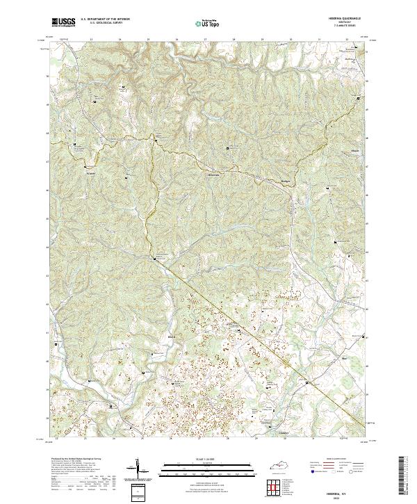
2022 Map of Hibernia
USGS Topo · Published 2022About this map
Hibernia and the surrounding drainages of Otter Creek define this landscape near the borders of LaRue, Green, and Taylor counties. The area is characterized by a dense network of country churches and family burial grounds, reflecting generations of settlement along the ridges and hollows. Notable landmarks include the New Bethlehem Baptist Church Cem in the north near Muldraugh Hill and the Union Separate Baptist Church Cem toward the center of the sheet.
Find a feature on this map
114 named features on this map. Tap any name to fly to it.
Don’t see what you’re looking for? This feature index may not catch every label — zoom into the map to look around manually.
Map Details
Editions of this 2022 Hibernia Map
This is the sole edition of this map. No revisions or reprints were ever made.
Other maps of this area

1953 · Howardstown
USGS Topo · 1:24,000

1953 · Saloma
USGS Topo · 1:24,000

1953 · Hudgins
USGS Topo · 1:24,000

1953 · Hibernia
USGS Topo · 1:24,000

1953 · Summersville
USGS Topo · 1:24,000

1953 · Magnolia
USGS Topo · 1:24,000
1953 · Hodgenville
USGS Topo · 1:24,000

1953 · Raywick
USGS Topo · 1:24,000

1954 · Greensburg
USGS Topo · 1:24,000

1957 · Winchester
USGS Topo · 1:250,000