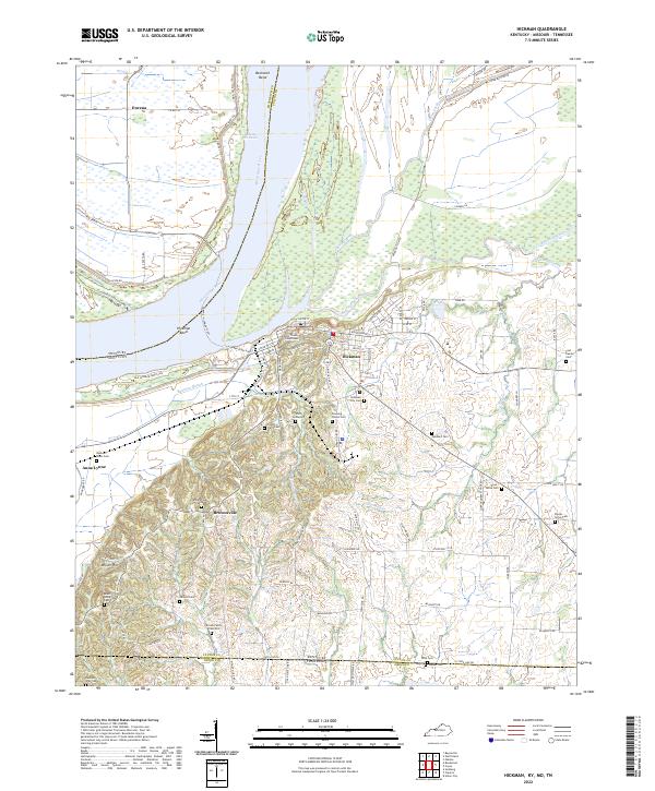
2022 Map of Hickman
USGS Topo · Published 2022About this map
Hickman serves as a critical riverfront hub along the Mississippi River, defined by its unique position where the bluffs meet the bottomlands at Hickman Bend. The town's administrative role is anchored by the Fulton County Courthouse, while its connection to the Missouri side of the river is maintained via the Dorena-Hickman Ferry. The landscape south of the city transitions into the rolling hills of Wilson Hill, a region densely dotted with family and community burial sites such as the Smith Graveyard and Brownsville Cem near the settlement of Brownsville.
Find a feature on this map
99 named features on this map. Tap any name to fly to it.
Don’t see what you’re looking for? This feature index may not catch every label — zoom into the map to look around manually.
Map Details
Editions of this 2022 Hickman Map
This is the sole edition of this map. No revisions or reprints were ever made.
Other maps of this area

1925 · Reelfoot Lake
USGS Topo · 1:62,500

1939 · Reelfoot Lake
USGS Topo · 1:62,500

1939 · Hickman
USGS Topo · 1:62,500

1939 · Bayouville
USGS Topo · 1:62,500

1951 · Cayce
USGS Topo · 1:24,000

1951 · Bondurant
USGS Topo · 1:24,000

1951 · Oakton
USGS Topo · 1:24,000

1951 · Hickman
USGS Topo · 1:24,000

1951 · Wolf Island
USGS Topo · 1:24,000

1954 · Union City
USGS Topo · 1:24,000