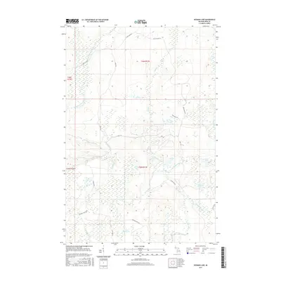
2017 Map of Hickman Lake
USGS Topo · Published 2017About this map
The Mitchigan River and Fence River converge in this remote timber and wetland region of Iron County, defining a landscape shaped by water and historic logging access. The terrain is a complex network of glacial lakes and creek systems, including the centrally located Bates Lake and Little Spring Lake. The naming of local infrastructure, such as Mead Logging Rd, Camp 1 Rd, and Camp 2 Rd, points to the area's long-standing reliance on the forestry industry. This 2017 survey details the hydrography of the Upper Peninsula's interior, where Netenphee Cr and Wilson Cr feed into the larger river branches. Sport and recreation are suggested by the presence of Deerfoot Lodge Rd, which leads toward the southern reaches near Lake Thirty Two.
Find a feature on this map
30 named features on this map. Tap any name to fly to it.
Don’t see what you’re looking for? This feature index may not catch every label — zoom into the map to look around manually.
Map Details
Editions of this 2017 Hickman Lake Map
This is the sole edition of this map. No revisions or reprints were ever made.
Other maps of this area

1895 · Ned Lake
USGS Topo · 1:62,500

1899 · Sagola
USGS Topo · 1:62,500

1899 · Witbeck
USGS Topo · 1:62,500

1899 · Crystal Falls
USGS Topo · 1:62,500

1945 · Kelso Junction
USGS Topo · 1:24,000

1947 · Kiernan
USGS Topo · 1:24,000

1947 · Kelso Junction
USGS Topo · 1:24,000

1955 · Witch Lake
USGS Topo · 1:24,000

1955 · Ned Lake
USGS Topo · 1:62,500

1955 · Witch Lake NE
USGS Topo · 1:24,000