
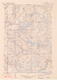
1947 Map of Kelso Junction
USGS Topo · Published 1947About this map
The Michigamme Reservoir dominates the central landscape of this Iron County survey, its irregular shoreline reaching through the township of Crystal Falls. This mid-century view shows a region defined by water management and heavy rail transit, anchored by the Gagnon Dam on McCutcheon Creek. The rail network is particularly dense for the era, featuring the Chicago and North Western and the Milwaukee St Paul and Pacific Railroad, which converge near Kelso Junction.
Find a feature on this map
21 named features on this map. Tap any name to fly to it.
Don’t see what you’re looking for? This feature index may not catch every label — zoom into the map to look around manually.
Map Details
Editions of this 1947 Kelso Junction Map
2 editions found
Other maps of this area

1895 · Ned Lake
USGS Topo · 1:62,500

1899 · Sagola
USGS Topo · 1:62,500

1899 · Witbeck
USGS Topo · 1:62,500

1899 · Crystal Falls
USGS Topo · 1:62,500

1944 · Crystal Falls
USGS Topo · 1:24,000

1944 · Fortune Lakes
USGS Topo · 1:24,000

1945 · Kelso Junction
USGS Topo · 1:24,000

1945 · Amasa
USGS Topo · 1:24,000

1946 · Crystal Falls
USGS Topo · 1:31,680

1946 · Fortune Lakes
USGS Topo · 1:31,680