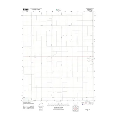
2012 Map of Hickok
USGS Topo · Published 2012About this map
Hickok stands as a primary point of reference in this Grant County landscape, defined by a rigid grid of agricultural roads and the sparse drainage of the High Plains. The small settlement is situated along Route 160, where the orthogonal network of section lines—marked by routes such as N Road Q and S Road R—dominates the geography. In the southwestern corner, the N Fk Cimarron R provides a rare natural break in the engineered landscape of fields and farm tracks. One notable exception to the strict grid is the Columbian Track, which cuts through the central sections. This survey illustrates the modern agricultural organization of Western Kansas, where the vast majority of named features are the literal boundaries of the township's land management system.
Find a feature on this map
24 named features on this map. Tap any name to fly to it.
Don’t see what you’re looking for? This feature index may not catch every label — zoom into the map to look around manually.
Map Details
Editions of this 2012 Hickok Map
This is the sole edition of this map. No revisions or reprints were ever made.
Other maps of this area

1891 · Larned
USGS Topo · 1:125,000

1900 · Lakin
USGS Topo · 1:125,000

1944 · Moscow
USGS Topo · 1:62,500

1945 · Moscow
USGS Topo · 1:62,500

1955 · Dodge City
USGS Topo · 1:250,000

1958 · Dodge City
USGS Topo · 1:250,000

1959 · Dodge City
USGS Topo · 1:250,000

1959 · Ulysses
USGS Topo · 1:24,000

1959 · Ulysses NE
USGS Topo · 1:24,000

1959 · Hickok NW
USGS Topo · 1:24,000