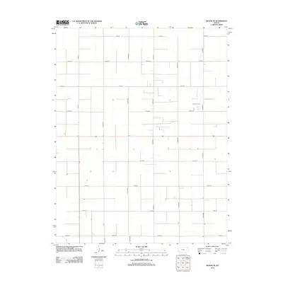
2012 Map of Hickok SE
USGS Topo · Published 2012About this map
Canaan Cem sits quietly amidst the organized grid of Grant County, Kansas, a defining landmark in this section of the High Plains. This 2012 survey reveals a landscape primarily dedicated to agriculture and natural resource extraction, most notably at the Eubank Oil Field. The territory is partitioned by a meticulous network of rural roads, including major corridors like Road X and Co Road BB, which facilitate the movement of local transit and industry. The presence of the cemetery alongside these active industrial sites provides a specific point of reference for genealogists tracking family roots in Sherman Township. While the map is dominated by the geometric precision of the township and range system, the subtle topographic variations and the integration of oil production sites into the farmland illustrate the modern economic character of western Kansas.
Find a feature on this map
24 named features on this map. Tap any name to fly to it.
Don’t see what you’re looking for? This feature index may not catch every label — zoom into the map to look around manually.
Map Details
Editions of this 2012 Hickok SE Map
This is the sole edition of this map. No revisions or reprints were ever made.
Other maps of this area

1891 · Larned
USGS Topo · 1:125,000

1896 · Garden
USGS Topo · 1:125,000

1900 · Lakin
USGS Topo · 1:125,000

1944 · Moscow
USGS Topo · 1:62,500

1945 · Moscow
USGS Topo · 1:62,500

1955 · Dodge City
USGS Topo · 1:250,000

1958 · Dodge City
USGS Topo · 1:250,000

1959 · Dodge City
USGS Topo · 1:250,000

1959 · Hickok NW
USGS Topo · 1:24,000

1959 · Hickok
USGS Topo · 1:24,000