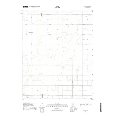
2018 Map of Hickok SE
USGS Topo · Published 2018About this map
High plains agriculture and the jurisdictional boundary between Grant Co and Haskell Co characterize this 2018 survey of western Kansas. The landscape is dominated by the Public Land Survey System grid, which dictates the placement of nearly every local thoroughfare, from Co Rd 90 in the north to Co Rd 170 at the southern edge. The small Canaan Cem stands as a notable landmark in the northeast quadrant, serving as a quiet focal point for local family history amidst the surrounding grain fields. Transportation routes like E Oklahoma Ave and North S Rd X bisect the townships of t28s r34w and t29s r35w, illustrating the precise, geometric division of the High Plains for industrial-scale farming and rural residency.
Find a feature on this map
27 named features on this map. Tap any name to fly to it.
Don’t see what you’re looking for? This feature index may not catch every label — zoom into the map to look around manually.
Map Details
Editions of this 2018 Hickok SE Map
This is the sole edition of this map. No revisions or reprints were ever made.
Other maps of this area

1891 · Larned
USGS Topo · 1:125,000

1896 · Garden
USGS Topo · 1:125,000

1900 · Lakin
USGS Topo · 1:125,000

1944 · Moscow
USGS Topo · 1:62,500

1945 · Moscow
USGS Topo · 1:62,500

1955 · Dodge City
USGS Topo · 1:250,000

1958 · Dodge City
USGS Topo · 1:250,000

1959 · Dodge City
USGS Topo · 1:250,000

1959 · Hickok NW
USGS Topo · 1:24,000

1959 · Hickok
USGS Topo · 1:24,000