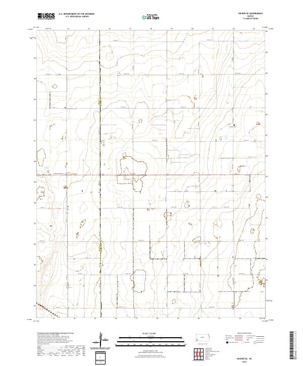
2022 Map of Hickok SE
USGS Topo · Published 2022About this map
Grant Co and Haskell Co meet along a straight north-south boundary line in this portion of the Kansas High Plains. The landscape is defined by an exacting section-line grid of local roads, such as Co Rd AA and Co Rd 100, which partition the territory into large agricultural blocks. Near the eastern edge of the survey, Canaan Cem stands as a quiet marker of early local settlement patterns along Co Rd EE. This modern survey reveals a highly organized rural infrastructure where arterial routes like E Oklahoma Ave cut across the grain of the county line. The topography is subtly punctuated by depressions and intermittent drainage features that break the geometric regularity of the farming landscape.
Find a feature on this map
29 named features on this map. Tap any name to fly to it.
Don’t see what you’re looking for? This feature index may not catch every label — zoom into the map to look around manually.
Map Details
Editions of this 2022 Hickok SE Map
This is the sole edition of this map. No revisions or reprints were ever made.
Other maps of this area

1891 · Larned
USGS Topo · 1:125,000

1896 · Garden
USGS Topo · 1:125,000

1900 · Lakin
USGS Topo · 1:125,000

1944 · Moscow
USGS Topo · 1:62,500

1945 · Moscow
USGS Topo · 1:62,500

1955 · Dodge City
USGS Topo · 1:250,000

1958 · Dodge City
USGS Topo · 1:250,000

1959 · Dodge City
USGS Topo · 1:250,000

1959 · Hickok NW
USGS Topo · 1:24,000

1959 · Hickok
USGS Topo · 1:24,000