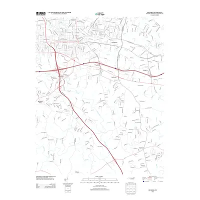
2013 Map of Hickory
USGS Topo · Published 2013About this map
The S Fork Catawba River and its many tributaries, including the Henry Fork and Jacob Fork, carve a complex drainage pattern across this Catawba County landscape. In the early 2010s, the area exhibits a dense suburban and industrial interface, particularly around the established communities of Brookford and Viewmont. The presence of the Hickory Speedway northeast of Fairbrook highlights the region's long-standing connection to local motorsports culture.
Find a feature on this map
305 named features on this map. Tap any name to fly to it.
Don’t see what you’re looking for? This feature index may not catch every label — zoom into the map to look around manually.
Map Details
Editions of this 2013 Hickory Map
This is the sole edition of this map. No revisions or reprints were ever made.
Other maps of this area

1895 · Hickory
USGS Topo · 1:125,000

1953 · Charlotte
USGS Topo · 1:250,000

1954 · Charlotte
USGS Topo · 1:250,000

1960 · Charlotte
USGS Topo · 1:250,000

1962 · Charlotte
USGS Topo · 1:250,000
1970 · Banoak
USGS Topo · 1:24,000
1970 · Maiden
USGS Topo · 1:24,000

1970 · Bethlehem
USGS Topo · 1:24,000

1970 · Newton
USGS Topo · 1:24,000
1970 · Granite Falls
USGS Topo · 1:24,000