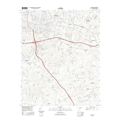
2016 Map of Hickory
USGS Topo · Published 2016About this map
Hickory and its surrounding communities are shown here at a moment of significant infrastructure, where the industrial past meets modern residential expansion. The campus of Lenoir Rhyne Univ and the historically significant Oakwood Cem anchor the urban core, while the presence of Shuford Mills Lake recalls the area's textile manufacturing heritage. The map details a complex transportation network, featuring CSX Transportation rail lines and major thoroughfares like Conover Blvd W and Catawba Valley Blvd SE.
Find a feature on this map
201 named features on this map. Tap any name to fly to it.
Don’t see what you’re looking for? This feature index may not catch every label — zoom into the map to look around manually.
Map Details
Editions of this 2016 Hickory Map
This is the sole edition of this map. No revisions or reprints were ever made.
Other maps of this area

1895 · Hickory
USGS Topo · 1:125,000

1953 · Charlotte
USGS Topo · 1:250,000

1954 · Charlotte
USGS Topo · 1:250,000

1960 · Charlotte
USGS Topo · 1:250,000

1962 · Charlotte
USGS Topo · 1:250,000
1970 · Banoak
USGS Topo · 1:24,000
1970 · Maiden
USGS Topo · 1:24,000

1970 · Bethlehem
USGS Topo · 1:24,000

1970 · Newton
USGS Topo · 1:24,000
1970 · Granite Falls
USGS Topo · 1:24,000