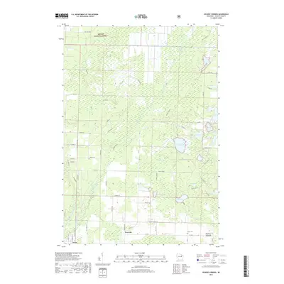
2018 Map of Hickory Corners
USGS Topo · Published 2018About this map
Hickory Corners and Frostville anchor the southern reach of this Oconto County landscape, which transitions from settled agricultural crossroads into the dense timberlands of the Nicolet National Forest. The map reveals a complex aquatic system of glacial depressions, including uniquely named features like Impassable Lake, No Muns Lake, and Funk Lake. The western edge is defined by the Peshtigo Brook corridor and the North Branch Oconto River near the village of Suring. A network of local roads such as Pipeline Rd, Butler Spring Rd, and Arbutus Ln connects these water bodies, while the Hickory Cem serves as a significant landmark for those researching the early families of the Oconto region. This survey captures the intersection of residential growth and the vast wetland environments that characterize northern Wisconsin.
Find a feature on this map
72 named features on this map. Tap any name to fly to it.
Don’t see what you’re looking for? This feature index may not catch every label — zoom into the map to look around manually.
Map Details
Editions of this 2018 Hickory Corners Map
This is the sole edition of this map. No revisions or reprints were ever made.
Other maps of this area

1941 · Coleman
USGS Topo · 1:48,000

1942 · Coleman
USGS Topo · 1:48,000

1942 · Breed
USGS Topo · 1:48,000

1950 · Coleman
USGS Topo · 1:48,000

1952 · Mountain
USGS Topo · 1:48,000

1954 · Iron Mountain
USGS Topo · 1:250,000

1955 · Green Bay
USGS Topo · 1:250,000

1956 · Gillett
USGS Topo · 1:62,500

1956 · Oconto Falls
USGS Topo · 1:62,500

1959 · Iron Mountain
USGS Topo · 1:250,000