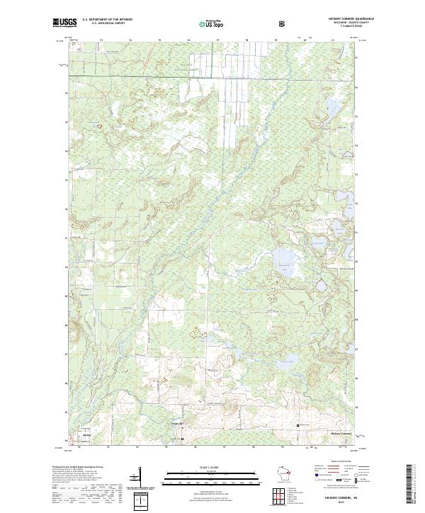
2023 Map of Hickory Corners
USGS Topo · Published 2023About this map
Hickory Corners and the surrounding wetlands of Oconto County define this landscape, where the North Branch Oconto River and Peshtigo Brook wind through the southern reaches of the Nicolet National Forest. Small settlements like Frostville and the village of Suring anchor a network of country roads, while the interior is dotted with numerous small water bodies including the curiously named Impassable Lake, No-Mans Lake, and Hoerth Lake.
Find a feature on this map
81 named features on this map. Tap any name to fly to it.
Don’t see what you’re looking for? This feature index may not catch every label — zoom into the map to look around manually.
Map Details
Editions of this 2023 Hickory Corners Map
This is the sole edition of this map. No revisions or reprints were ever made.
Other maps of this area

1941 · Coleman
USGS Topo · 1:48,000

1942 · Coleman
USGS Topo · 1:48,000

1942 · Breed
USGS Topo · 1:48,000

1950 · Coleman
USGS Topo · 1:48,000

1952 · Mountain
USGS Topo · 1:48,000

1954 · Iron Mountain
USGS Topo · 1:250,000

1955 · Green Bay
USGS Topo · 1:250,000

1956 · Gillett
USGS Topo · 1:62,500

1956 · Oconto Falls
USGS Topo · 1:62,500

1959 · Iron Mountain
USGS Topo · 1:250,000