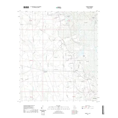
2020 Map of Hickory
USGS Topo · Published 2020About this map
Honey Island Swamp and the sprawling waterways of the West Pearl River dominate this portion of eastern Louisiana. The landscape is defined by its complex hydrography, including the Pearl River Canal, Ernest Slough, and the Old River loops that create isolated landmasses like Holmes Island and Doghead Island. Settlement is concentrated along the higher ground of the Hickory and Florenville areas, where a network of family-named roads like Edgar Kennedy Rd and Archie Singletary Rd connect the community. Numerous small burial grounds, such as Austin Cem and Charter Oak Cem, are scattered throughout the region, reflecting the local family history and genealogical roots of these rural communities. The map also captures the varied terrain of river bottomlands, featuring the named hammocks of Pats Hammock and Mitchell Hammock.
Find a feature on this map
109 named features on this map. Tap any name to fly to it.
Don’t see what you’re looking for? This feature index may not catch every label — zoom into the map to look around manually.
Map Details
Editions of this 2020 Hickory Map
This is the sole edition of this map. No revisions or reprints were ever made.
Other maps of this area

1914 · Nicholson
USGS Topo · 1:62,500

1921 · Nicholson
USGS Topo · 1:62,500

1935 · Slidell
USGS Topo · 1:62,500

1939 · Slidell
USGS Topo · 1:62,500

1941 · Honey Island
USGS Topo · 1:31,680

1942 · Talisheek
USGS Topo · 1:31,680

1942 · Walkiah Bluff
USGS Topo · 1:31,680

1950 · Haaswood
USGS Topo · 1:31,680

1950 · Slidell
USGS Topo · 1:62,500

1953 · Mobile
USGS Topo · 1:250,000