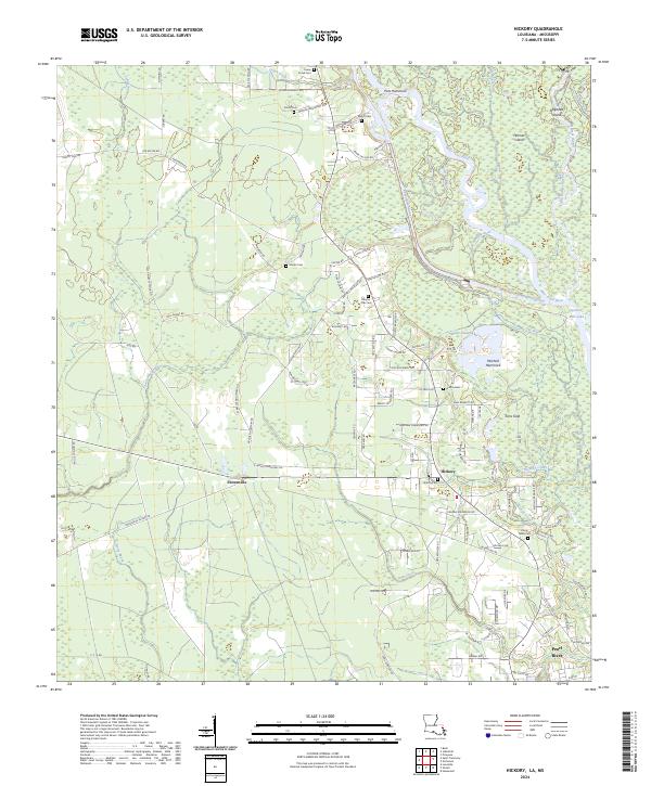
2024 Map of Hickory
USGS Topo · Published 2024About this map
Bogue Chitto National Wildlife Refuge dominates the eastern portion of this St. Tammany Parish landscape, preserving a complex network of bayous and sloughs where the West Pearl River and Pearl-River-Canal diverge. The map reveals a transition from the dense, saturated environments of Honey Island Swamp and Maple Slough to the upland settlements of Florenville and Hickory. The region's social history is deeply etched into the land through numerous small burial grounds like Charter Oak Cem, Moran Cem, and Welch Cem, many of which are tucked along family-named roads such as Herman Singletary Rd and Edgar Kennedy Rd. A distinct pattern of loops and extensions, including Blueberry Loop and Putt Moran Loop, suggests a long history of rural land division and timber access leading toward the southern reaches of Pearl River.
Find a feature on this map
120 named features on this map. Tap any name to fly to it.
Don’t see what you’re looking for? This feature index may not catch every label — zoom into the map to look around manually.
Map Details
Editions of this 2024 Hickory Map
This is the sole edition of this map. No revisions or reprints were ever made.
Other maps of this area

1914 · Nicholson
USGS Topo · 1:62,500

1921 · Nicholson
USGS Topo · 1:62,500

1935 · Slidell
USGS Topo · 1:62,500

1939 · Slidell
USGS Topo · 1:62,500

1941 · Honey Island
USGS Topo · 1:31,680

1942 · Talisheek
USGS Topo · 1:31,680

1942 · Walkiah Bluff
USGS Topo · 1:31,680

1950 · Haaswood
USGS Topo · 1:31,680

1950 · Slidell
USGS Topo · 1:62,500

1953 · Mobile
USGS Topo · 1:250,000