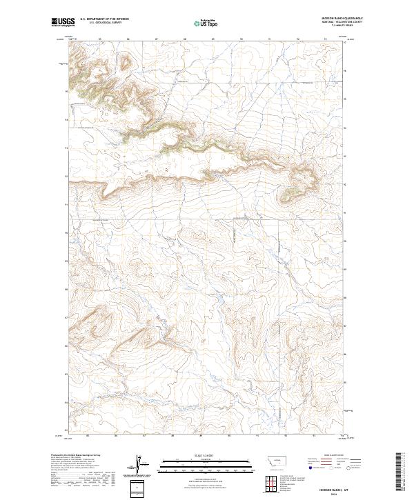
2024 Map of Hickson Ranch
USGS Topo · Published 2024About this map
The high plains of Yellowstone County define this landscape, where seasonal drainages have etched deep relief into the Montana terrain. The water system is dominated by the west-to-east flow of Five Mile Creek in the south and Twelve Mile Creek across the central portion, while the northern hills are cut by the winding Burnt Coulee. This is a rural ranching environment structured by a sparse grid of section lines and gravel access routes. Long-established county roads like Shepherd Acton Rd and Alexander Rd provide the primary transit through these expansive townships, connecting remote homesteads and grazing lands. The topography shows the characteristic Montana transition from flat benchlands to dissected breaks, a pattern essential for local livestock management and land use planning.
Find a feature on this map
12 named features on this map. Tap any name to fly to it.
Don’t see what you’re looking for? This feature index may not catch every label — zoom into the map to look around manually.
Map Details
Editions of this 2024 Hickson Ranch Map
This is the sole edition of this map. No revisions or reprints were ever made.
Other maps of this area

1893 · Huntley
USGS Topo · 1:125,000

1954 · Billings
USGS Topo · 1:250,000

1954 · Roundup
USGS Topo · 1:250,000

1956 · Rattlesnake Butte
USGS Topo · 1:24,000

1956 · Acton
USGS Topo · 1:24,000

1956 · Hickson Ranch
USGS Topo · 1:24,000

1956 · Rimrock
USGS Topo · 1:24,000

1956 · Billings East
USGS Topo · 1:24,000

1957 · Billings
USGS Topo · 1:250,000

1957 · Billings West
USGS Topo · 1:24,000