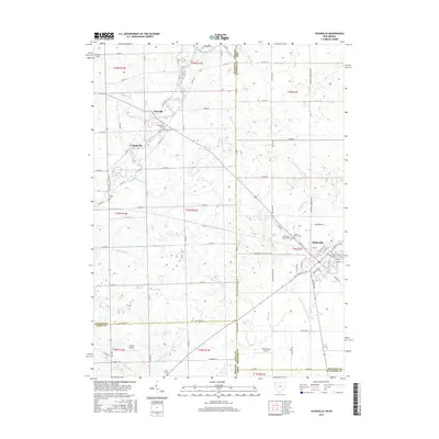
2016 Map of Hicksville
USGS Topo · Published 2016About this map
Hicksville anchors this borderland survey, situated where the Gordon Cr and Mill Cr drainage systems converge. The map illustrates a landscape defined by an extensive network of drainage infrastructure, including the Nancy Davis Ditch, Walker Ditch, and Hook Ditch, reflecting the intensive agricultural management of the Ohio-Indiana state line region. Along the Saint Joseph River, the small settlements of Newville and Orangeville appear, maintaining their historical footprints amidst a grid of county roads. For those tracing family histories, the sheet is notably dense with burial sites such as Forest Home Cem, Old Forest Home Cem, and Riverside Cem. The presence of Greuter Field, Hilltop Airport, and Howensting Airport indicates a significant role for general aviation in this rural corridor spanning Defiance and Allen counties in Ohio and DeKalb County in Indiana.
Find a feature on this map
77 named features on this map. Tap any name to fly to it.
Don’t see what you’re looking for? This feature index may not catch every label — zoom into the map to look around manually.
Map Details
Editions of this 2016 Hicksville Map
This is the sole edition of this map. No revisions or reprints were ever made.
Other maps of this area

1914 · Bryan
USGS Topo · 1:62,500

1914 · Paulding
USGS Topo · 1:62,500

1943 · Bryan
USGS Topo · 1:62,500

1944 · Paulding
USGS Topo · 1:62,500

1953 · Fort Wayne
USGS Topo · 1:250,000

1956 · Fort Wayne
USGS Topo · 1:250,000

1958 · Hicksville
USGS Topo · 1:24,000

1958 · Grabill
USGS Topo · 1:24,000

1958 · Butler West
USGS Topo · 1:24,000

1958 · Woodburn North
USGS Topo · 1:24,000