
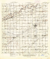
1914 Map of Paulding
USGS Topo · Published 1942About this map
Maumee River meanders across the northern reaches of this northwest Ohio landscape, carving a wide valley through Carryall and Crane townships. The map documents a critical moment of industrial transition, showing the Wabash Canal (Abandoned) running parallel to the Wabash R R, illustrating the era when railroads finally superseded the historic water-borne trade routes. The county seat of Paulding serves as a central hub, where the Cincinnati Northern R R intersects with local commerce near the Infirmary.
Find a feature on this map
119 named features on this map. Tap any name to fly to it.
Don’t see what you’re looking for? This feature index may not catch every label — zoom into the map to look around manually.
Map Details
Editions of this 1914 Paulding Map
2 editions found
Other maps of this area

1907 · Defiance
USGS Topo · 1:62,500

1909 · Defiance
USGS Topo · 1:62,500

1909 · Continental
USGS Topo · 1:62,500

1911 · Delphos
USGS Topo · 1:62,500

1914 · Van Wert
USGS Topo · 1:62,500

1914 · Bryan
USGS Topo · 1:62,500

1943 · Bryan
USGS Topo · 1:62,500

1944 · Delphos
USGS Topo · 1:62,500

1944 · Van Wert
USGS Topo · 1:62,500

1944 · Paulding
USGS Topo · 1:62,500