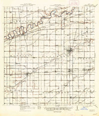
1914 Map of Paulding
USGS Topo · Published 1948About this map
The Maumee River winds through the northern reaches of this northwest Ohio landscape, anchoring a region defined by its transition from water-based transport to an extensive rail network. The county seat of Paulding sits as a central hub, while the presence of a Canal Abandoned running parallel to the Wabash RR near Antwerp and Cecil marks the shifting industrial priorities of the early twentieth century. This era of development is etched into the landscape through a dense grid of numbered and named rural schools, including Columbia School, Elmtree School, and Champion School, which served the scattered farming communities of Carryall and Blue Creek townships. The map records a complex hydrological system of natural waterways like Flatrook Creek alongside man-made improvements such as the Webster Ditch and Worm Ditch, reflecting the significant drainage efforts required to utilize the fertile black swamp soils for agriculture.
Find a feature on this map
123 named features on this map. Tap any name to fly to it.
Don’t see what you’re looking for? This feature index may not catch every label — zoom into the map to look around manually.
Map Details
Editions of this 1914 Paulding Map
2 editions found
Other maps of this area

1907 · Defiance
USGS Topo · 1:62,500

1909 · Defiance
USGS Topo · 1:62,500

1909 · Continental
USGS Topo · 1:62,500

1911 · Delphos
USGS Topo · 1:62,500

1914 · Van Wert
USGS Topo · 1:62,500

1914 · Bryan
USGS Topo · 1:62,500

1914 · Paulding
USGS Topo · 1:62,500

1943 · Bryan
USGS Topo · 1:62,500

1944 · Delphos
USGS Topo · 1:62,500

1944 · Van Wert
USGS Topo · 1:62,500