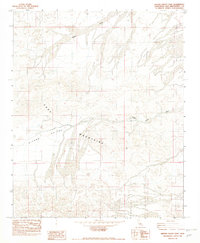
1982 Map of Hidden Valley East
USGS Topo · Published 1982About this map
Cady Mountains dominate the central relief of this 1982 provisional survey, showcasing a complex network of arid drainage systems and desert terrain in San Bernardino County. The map captures the meeting point of high-elevation landforms and broad alluvial fans, particularly where Baxter Wash and other unnamed tributaries flow out from the mountain slopes. The northern reach of Hidden Valley is clearly delineated, providing a topographic record of the basin's floor before the widespread use of more modern digital mapping techniques. This edition, produced from manuscript drawings based on 1970s aerial photography, emphasizes natural landform morphology rather than human development, making it an essential reference for understanding the physical geography of the Mojave region at the dawn of the 1980s.
Find a feature on this map
5 named features on this map. Tap any name to fly to it.
Don’t see what you’re looking for? This feature index may not catch every label — zoom into the map to look around manually.
Map Details
Editions of this 1982 Hidden Valley East Map
2 editions found
Other maps of this area

1933 · Avawatz Mountains
USGS Topo · 1:250,000

1947 · Trona
USGS Topo · 1:250,000

1948 · Trona
USGS Topo · 1:250,000

1948 · Cave Mountain
USGS Topo · 1:62,500

1951 · Cave Mountain
USGS Topo · 1:62,500

1953 · San Bernardino
USGS Topo · 1:250,000

1953 · Trona
USGS Topo · 1:250,000

1955 · Cady Mountains
USGS Topo · 1:62,500

1955 · Broadwell Lake
USGS Topo · 1:62,500

1956 · San Bernardino
USGS Topo · 1:250,000