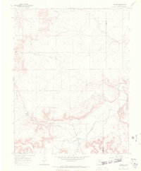
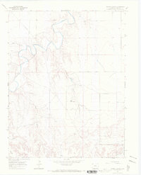
1966 Map of Higbee
USGS Topo · Published 1970About this map
The Purgatoire River Valley forms the central axis of this Otero County landscape, where the confluence of numerous arroyos and canyons defines the local topography. The settlement of Higbee serves as the community hub, supported by the Higbee Valley Sch and the Higbee Cem. The area is characterized by an extensive network of dry watercourses, including Alkali Arroyo, Salt Arroyo, and McMahon Arroyo, which cut through the high plains toward the river.
Find a feature on this map
17 named features on this map. Tap any name to fly to it.
Don’t see what you’re looking for? This feature index may not catch every label — zoom into the map to look around manually.
Map Details
Editions of this 1966 Higbee Map
2 editions found
Other maps of this area

1891 · Higbee
USGS Topo · 1:125,000

1891 · Timpas
USGS Topo · 1:125,000

1893 · Higbee
USGS Topo · 1:125,000

1894 · Timpas
USGS Topo · 1:125,000

1955 · La Junta
USGS Topo · 1:250,000

1958 · La Junta
USGS Topo · 1:250,000

1966 · La Junta SE
USGS Topo · 1:24,000
1966 · Hackamore Ranch
USGS Topo · 1:24,000
1966 · La Junta
USGS Topo · 1:24,000
1966 · Turkey Canyon
USGS Topo · 1:24,000