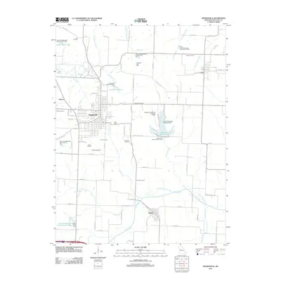
2012 Map of Higginsville
USGS Topo · Published 2012About this map
Higginsville serves as the central hub of this Lafayette County landscape, surrounded by a complex network of watershed management structures and local landmarks. The area's genealogical history is well-preserved through numerous burial sites, including Page Cemetery in the north and the Republican Cemetery near the center of the sheet. The landscape is defined by its water management, featuring a series of Tabo Creek Watershed structures and dams like Gash Dam and Starke Lake Dam that regulate the local drainage.
Find a feature on this map
90 named features on this map. Tap any name to fly to it.
Don’t see what you’re looking for? This feature index may not catch every label — zoom into the map to look around manually.
Map Details
Editions of this 2012 Higginsville Map
This is the sole edition of this map. No revisions or reprints were ever made.
Other maps of this area

1885 · Warrensburg
USGS Topo · 1:125,000

1887 · Warrensburg
USGS Topo · 1:125,000

1889 · Lexington
USGS Topo · 1:125,000

1894 · Warrensburg
USGS Topo · 1:125,000

1917 · Knobnoster
USGS Topo · 1:62,500

1947 · Jefferson City
USGS Topo · 1:250,000

1949 · Mayview
USGS Topo · 1:24,000

1949 · Lexington East
USGS Topo · 1:24,000

1950 · Lexington East
USGS Topo · 1:24,000

1950 · Mayview
USGS Topo · 1:24,000