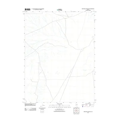
2012 Map of High Bald Peaks SE
USGS Topo · Published 2012About this map
Paris Creek flows through this high-altitude section of Elko County, marking one of the few named water features in a landscape dominated by drainage patterns and desert terrain. This 2012 survey by the U.S. Geological Survey illustrates the transition of the Great Basin's topography, where intermittent streams and washes provide the primary structural detail. The sparse nomenclature emphasizes the isolation of this region, with Paris Creek serving as a vital landmark for understanding the local hydrography and elevation changes across the quadrangle. For those studying the remote northern Nevada interior, the map provides precise data on the natural drainage networks that define this section of the High Bald Peaks area.
Find a feature on this map
1 named feature on this map. Tap any name to fly to it.
Don’t see what you’re looking for? This feature index may not catch every label — zoom into the map to look around manually.
Map Details
Editions of this 2012 High Bald Peaks SE Map
This is the sole edition of this map. No revisions or reprints were ever made.
Other maps of this area

1955 · Elko
USGS Topo · 1:250,000

1956 · Ely
USGS Topo · 1:250,000

1958 · Elko
USGS Topo · 1:250,000

1959 · Ely
USGS Topo · 1:250,000

1962 · Elko
USGS Topo · 1:250,000

1963 · Ely
USGS Topo · 1:250,000

1965 · Elko
USGS Topo · 1:250,000
1982 · Ninemile Well
USGS Topo · 1:24,000
1982 · Exchequer Spring
USGS Topo · 1:24,000
1982 · Ninemile Well NW
USGS Topo · 1:24,000