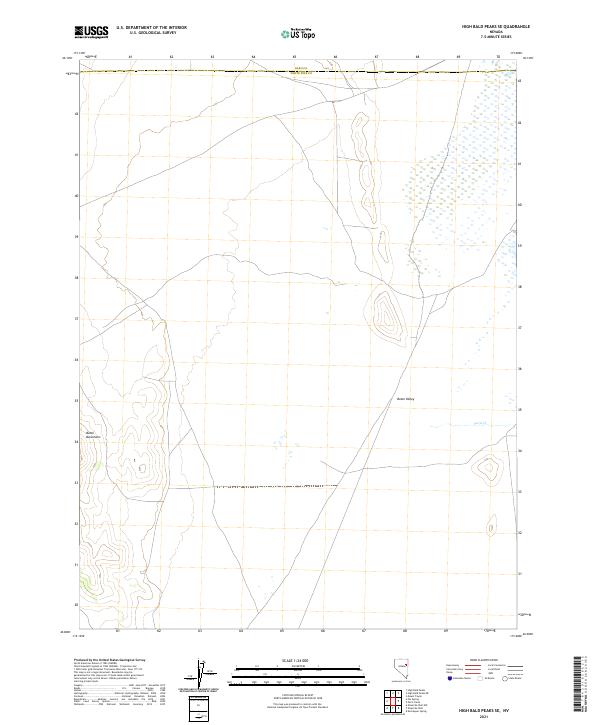
2021 Map of High Bald Peaks SE
USGS Topo · Published 2021About this map
Butte Valley dominates this high-desert basin in eastern Nevada, where the drainage of Paris Cr filters through a landscape defined by expansive public land divisions. The terrain is framed by the steep rise of the Butte Mountains to the west, a prominent landmark for those tracing old pack trails or early ranching corridors through the Great Basin. This contemporary survey by the U.S. Geological Survey preserves the administrative boundaries between Elko Co and White Pine Co, reflecting the enduring surveyor’s grid that has organized this open country since the nineteenth century. For the local historian or geographer, the map illustrates the delicate water systems and township structures within the t26n r61e and t25n r61e sections that continue to shape land use in this part of the state.
Find a feature on this map
8 named features on this map. Tap any name to fly to it.
Don’t see what you’re looking for? This feature index may not catch every label — zoom into the map to look around manually.
Map Details
Editions of this 2021 High Bald Peaks SE Map
This is the sole edition of this map. No revisions or reprints were ever made.
Other maps of this area

1955 · Elko
USGS Topo · 1:250,000

1956 · Ely
USGS Topo · 1:250,000

1958 · Elko
USGS Topo · 1:250,000

1959 · Ely
USGS Topo · 1:250,000

1962 · Elko
USGS Topo · 1:250,000

1963 · Ely
USGS Topo · 1:250,000

1965 · Elko
USGS Topo · 1:250,000

1982 · Ninemile Well
USGS Topo · 1:24,000

1982 · Exchequer Spring
USGS Topo · 1:24,000
1982 · Ninemile Well NW
USGS Topo · 1:24,000