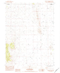
1984 Map of High Bald Peaks SE
USGS Topo · Published 1984About this map
The Butte Valley floor and the rising slopes of the Butte Mountains define this Great Basin landscape on the border of Elko Co and White Pine Co. Produced as a provisional survey in the mid-1980s, the map illustrates a sparsely settled region where human activity is primarily limited to resource management and high-desert navigation. Several instances of a Corral mark the area, indicating the continued use of these basins for livestock grazing.
Find a feature on this map
7 named features on this map. Tap any name to fly to it.
Don’t see what you’re looking for? This feature index may not catch every label — zoom into the map to look around manually.
Map Details
Editions of this 1984 High Bald Peaks SE Map
This is the sole edition of this map. No revisions or reprints were ever made.
Other maps of this area

1955 · Elko
USGS Topo · 1:250,000

1956 · Ely
USGS Topo · 1:250,000

1958 · Elko
USGS Topo · 1:250,000

1959 · Ely
USGS Topo · 1:250,000

1962 · Elko
USGS Topo · 1:250,000

1963 · Ely
USGS Topo · 1:250,000

1965 · Elko
USGS Topo · 1:250,000

1982 · Ninemile Well
USGS Topo · 1:24,000

1982 · Exchequer Spring
USGS Topo · 1:24,000
1982 · Ninemile Well NW
USGS Topo · 1:24,000