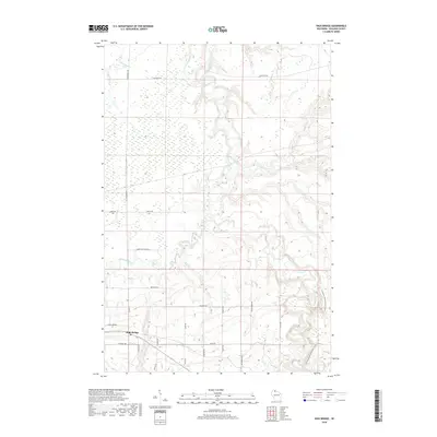
2018 Map of High Bridge
USGS Topo · Published 2018About this map
High Bridge serves as the primary settlement hub in this part of Ashland County, situated at the intersection of several rural routes and the local Po. The landscape is defined by a dense drainage network where the Bad River and its tributaries, including the Marengo River and Potato River, cut through the terrain. A notable geographic landmark, Brownstone Falls, is located in the northeastern section of the quadrangle near the confluence of the Bad River and Vaughn Cr.
Find a feature on this map
33 named features on this map. Tap any name to fly to it.
Don’t see what you’re looking for? This feature index may not catch every label — zoom into the map to look around manually.
Map Details
Editions of this 2018 High Bridge Map
This is the sole edition of this map. No revisions or reprints were ever made.
Other maps of this area

1942 · Ashland
USGS Topo · 1:48,000

1942 · Mellen
USGS Topo · 1:48,000

1942 · Marengo
USGS Topo · 1:48,000

1943 · Odanah
USGS Topo · 1:48,000

1945 · Odanah
USGS Topo · 1:48,000

1945 · Marengo
USGS Topo · 1:48,000

1945 · Mellen
USGS Topo · 1:48,000

1947 · Ashland
USGS Topo · 1:48,000

1953 · Ashland
USGS Topo · 1:250,000
1956 · Mt. Whittlesey
USGS Topo · 1:24,000