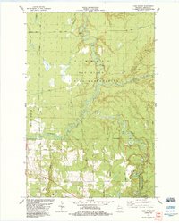
1984 Map of High Bridge
USGS Topo · Published 1984About this map
The Bad River and its major tributaries, the Potato River and Marengo River, dominate this landscape within the Sanborn Indian Reservation. The river systems are characterized by dramatic relief and complex drainage patterns, culminating in the falls and rapids of Copper Falls State Park, where the river drops over Brownstone Falls. The settlement of High Bridge serves as a small rail and road hub in the southwestern portion of the map, situated along the Soo Line and Coria Road.
Find a feature on this map
36 named features on this map. Tap any name to fly to it.
Don’t see what you’re looking for? This feature index may not catch every label — zoom into the map to look around manually.
Map Details
Editions of this 1984 High Bridge Map
This is the sole edition of this map. No revisions or reprints were ever made.
Other maps of this area

1942 · Ashland
USGS Topo · 1:48,000

1942 · Mellen
USGS Topo · 1:48,000

1942 · Marengo
USGS Topo · 1:48,000

1943 · Odanah
USGS Topo · 1:48,000

1945 · Odanah
USGS Topo · 1:48,000

1945 · Marengo
USGS Topo · 1:48,000

1945 · Mellen
USGS Topo · 1:48,000

1947 · Ashland
USGS Topo · 1:48,000

1953 · Ashland
USGS Topo · 1:250,000
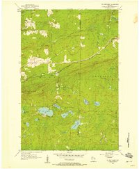
1956 · Mt. Whittlesey
USGS Topo · 1:24,000