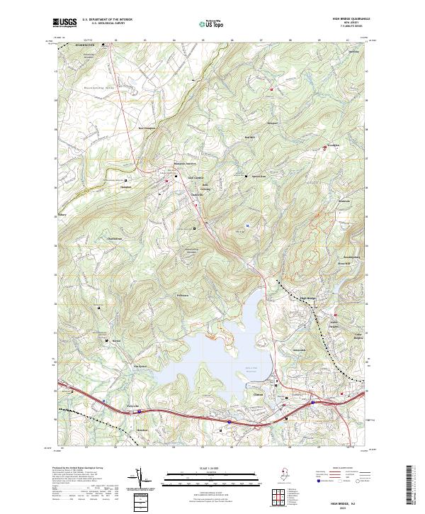
2023 Map of High Bridge
USGS Topo · Published 2023About this map
Spruce Run Reservoir dominates the central landscape of Hunterdon County, serving as a modern focal point for an area defined by deep historical roots. The terrain is structured by the prominent ridges of Pohatcong Mountain and Musconetcong Mountain, which frame the agricultural and industrial corridors of the Musconetcong Valley. At the town of High Bridge, the waters of the South Branch Raritan River flow past Lake Solitude, while the legacy of early industry remains visible at the Red Mill and the milling site of Stone Mill. For researchers, the map is densely packed with family and community history, preserving the locations of numerous small settlements like Polktown, Van Syckel, and Woodglen. Local heritage is anchored by significant religious sites including the Norton Methodist Episcopal Churchyard, Saint Anns Catholic Church Cem, and the Spruce Run Lutheran Cem.
Find a feature on this map
237 named features on this map. Tap any name to fly to it.
Don’t see what you’re looking for? This feature index may not catch every label — zoom into the map to look around manually.
Map Details
Editions of this 2023 High Bridge Map
This is the sole edition of this map. No revisions or reprints were ever made.
Other maps of this area

1888 · Hackettstown
USGS Topo · 1:62,500

1890 · Easton
USGS Topo · 1:62,500

1890 · High Bridge
USGS Topo · 1:62,500

1891 · Easton
USGS Topo · 1:62,500

1891 · Delaware Water Gap
USGS Topo · 1:62,500

1893 · Delaware Water Gap
USGS Topo · 1:62,500

1894 · Hackettstown
USGS Topo · 1:62,500

1898 · Hackettstown
USGS Topo · 1:62,500

1898 · High Bridge
USGS Topo · 1:62,500

1900 · Raritan
USGS Topo · 1:125,000