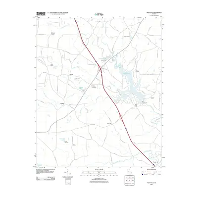
2011 Map of High Falls
USGS Topo · Published 2011About this map
The Towaliga River and its varied tributaries dominate this landscape in north-central Georgia, as seen during the early twenty-first century. The area is characterized by several historic small-scale settlements, including Chappel, Unionville, and Weldons Crossroads. Water management is a key theme of the topography, with significant structures such as the High Falls Lake Dam and the Corrections Dam creating the sizable High Falls Lake and Corrections Lake. These reservoirs, along with the smaller English Lake, reflect a hydrography that has been managed for both utility and recreation.
Find a feature on this map
90 named features on this map. Tap any name to fly to it.
Don’t see what you’re looking for? This feature index may not catch every label — zoom into the map to look around manually.
Map Details
Editions of this 2011 High Falls Map
This is the sole edition of this map. No revisions or reprints were ever made.
Other maps of this area

1951 · Forsyth
USGS Topo · 1:62,500

1951 · Barnesville
USGS Topo · 1:62,500

1953 · Atlanta
USGS Topo · 1:250,000

1953 · Athens
USGS Topo · 1:250,000

1957 · Atlanta
USGS Topo · 1:250,000

1958 · Athens
USGS Topo · 1:250,000

1958 · Atlanta
USGS Topo · 1:250,000

1959 · Athens
USGS Topo · 1:250,000

1963 · Athens
USGS Topo · 1:250,000

1964 · Luella
USGS Topo · 1:24,000