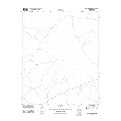
2011 Map of High Lonesome Well
USGS Topo · Published 2011About this map
High Lonesome Well and a series of vital water points define this high desert landscape on the border of Arizona and New Mexico. This 2011 survey, published by the U.S. Geological Survey, illustrates a territory shaped by the movement of livestock and the maintenance of essential infrastructure in an arid environment. The map details an sparse network of Bureau of Indian Affairs corridors, including Indian Service Route 23 and Indian Service Route 39, which connect isolated water sources across the plateau. Ranching and pastoral heritage is evident through named features like East Pasture Well, East Pasture Tank, and the Straddling Well. This study reflects the continued importance of water management in the region, where every North Well represents a critical node in the local economy and land use pattern.
Find a feature on this map
8 named features on this map. Tap any name to fly to it.
Don’t see what you’re looking for? This feature index may not catch every label — zoom into the map to look around manually.
Map Details
Editions of this 2011 High Lonesome Well Map
This is the sole edition of this map. No revisions or reprints were ever made.
Other maps of this area
1886 · St Johns
USGS Topo · 1:250,000
1886 · Wingate
USGS Topo · 1:250,000
1886 · Fort Defiance
USGS Topo · 1:250,000
1892 · Fort Defiance
USGS Topo · 1:250,000
1892 · St Johns
USGS Topo · 1:250,000
1892 · Wingate
USGS Topo · 1:250,000

1954 · Saint Johns
USGS Topo · 1:250,000

1954 · Gallup
USGS Topo · 1:250,000

1957 · Saint Johns
USGS Topo · 1:250,000
1958 · Gallup
USGS Topo · 1:250,000