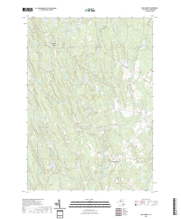
2023 Map of High Market
USGS Topo · Published 2023About this map
Michigan Mills and the tiny settlement of Fish Creek anchor this landscape in Lewis County, where the hydrological divide separates waters flowing toward the Tug Hill region. The map reveals an intricate network of waterways, including the East Branch Fish Creek and the West Branch Sugar River, which have historically shaped the local timber and milling industries. Numerous seasonal trails and rural roads like Michigan Mills Rd and Byrons Corners Rd crisscross the terrain, connecting isolated pockets of the forest.
Find a feature on this map
47 named features on this map. Tap any name to fly to it.
Don’t see what you’re looking for? This feature index may not catch every label — zoom into the map to look around manually.
Map Details
Editions of this 2023 High Market Map
This is the sole edition of this map. No revisions or reprints were ever made.
Other maps of this area

1904 · Boonville
USGS Topo · 1:62,500

1905 · Port Leyden
USGS Topo · 1:62,500

1905 · Taberg
USGS Topo · 1:62,500

1906 · Highmarket
USGS Topo · 1:62,500

1907 · Port Leyden
USGS Topo · 1:62,500

1940 · Port Leyden
USGS Topo · 1:62,500

1943 · East Florence
USGS Topo · 1:31,680
1943 · Sears Pond
USGS Topo · 1:31,680
1943 · North Osceola
USGS Topo · 1:24,000

1943 · High Market
USGS Topo · 1:24,000