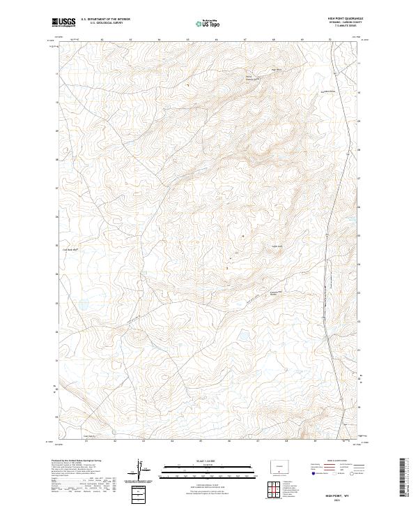
2021 Map of High Point
USGS Topo · Published 2021About this map
The Continental Divide traverses the high desert landscape of Carbon County, Wyoming, in this contemporary topographic record. The terrain is characterized by a network of drainage features and prominent landforms such as High Point and Sugar Loaf. These features reflect the complex hydrology of the Great Divide Basin, where seasonal water flow is marked by Coal Bank Wash and Antelope Cr.
Find a feature on this map
14 named features on this map. Tap any name to fly to it.
Don’t see what you’re looking for? This feature index may not catch every label — zoom into the map to look around manually.
Map Details
Editions of this 2021 High Point Map
This is the sole edition of this map. No revisions or reprints were ever made.
Other maps of this area

1954 · Rawlins
USGS Topo · 1:250,000

1957 · Doty Mountain
USGS Topo · 1:62,500

1958 · Rawlins
USGS Topo · 1:250,000

1962 · Rawlins
USGS Topo · 1:250,000

1966 · Creston Junction
USGS Topo · 1:24,000

1966 · Wamsutter
USGS Topo · 1:24,000

1966 · Seaverson Reservoir
USGS Topo · 1:24,000

1966 · Creston
USGS Topo · 1:24,000

1966 · High Point
USGS Topo · 1:24,000

1966 · Eightmile Lake
USGS Topo · 1:24,000