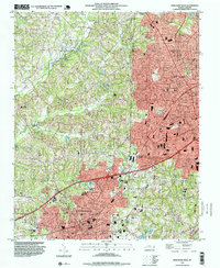
1993 Map of High Point West
USGS Topo · Published 1999About this map
High Point and Thomasville dominate the landscape of the Piedmont in the early 1990s, revealing a dense corridor of growth along the Southern railroad and Interstate 85. This area, spanning the borders of Davidson, Guilford, and Randolph counties, shows a complex network of suburban expansion into the drainages of Abbotts Creek and Rich Fork. The map provides significant genealogical and institutional detail, locating numerous schools like Westchester Academy and Johnson Street Sch, alongside neighborhood spiritual centers such as Hedgecock Chapel and Pleasant Grove Ch. The presence of large industrial and civic markers, including the City Memorial Hospital and various radio towers like Radio Towers (WMFR), reflects the mid-to-late 20th-century development of these major North Carolina furniture and textile hubs.
Find a feature on this map
51 named features on this map. Tap any name to fly to it.
Don’t see what you’re looking for? This feature index may not catch every label — zoom into the map to look around manually.
Map Details
Editions of this 1993 High Point West Map
This is the sole edition of this map. No revisions or reprints were ever made.
Other maps of this area

1949 · Eller
USGS Topo · 1:24,000

1949 · High Point West
USGS Topo · 1:24,000

1950 · High Point East
USGS Topo · 1:24,000

1950 · Lexington East
USGS Topo · 1:24,000

1950 · Winston-Salem East
USGS Topo · 1:24,000

1951 · Winston-Salem East
USGS Topo · 1:24,000

1951 · Lexington East
USGS Topo · 1:24,000

1951 · High Point East
USGS Topo · 1:24,000

1951 · Guilford
USGS Topo · 1:24,000

1951 · Fair Grove
USGS Topo · 1:24,000