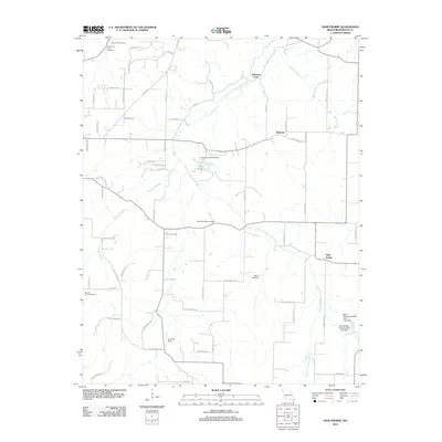
2012 Map of High Prairie
USGS Topo · Published 2012About this map
The Osage Fork Gasconade River meanders across this rural Webster County landscape, serving as a primary geographic anchor for small communities like Johnston Ford and Bracken. In the early 21st century, this area remains characterized by a high density of family and community burial grounds, including the Shields-Corinth Cemetery, Moore Cemetery, and the Robertson- Buck Cemetery. These sites, along with others such as Mount Sinai Cemetery, provide a significant record of local lineage in a region defined by its dispersed settlement pattern.
Find a feature on this map
71 named features on this map. Tap any name to fly to it.
Don’t see what you’re looking for? This feature index may not catch every label — zoom into the map to look around manually.
Map Details
Editions of this 2012 High Prairie Map
This is the sole edition of this map. No revisions or reprints were ever made.
Other maps of this area

1939 · Fordland
USGS Topo · 1:62,500

1942 · Fordland
USGS Topo · 1:62,500

1946 · Niangua
USGS Topo · 1:62,500

1948 · Niangua
USGS Topo · 1:62,500

1951 · Mansfield NW
USGS Topo · 1:24,000

1954 · Springfield
USGS Topo · 1:250,000

1956 · Duncan
USGS Topo · 1:24,000

1956 · Rader
USGS Topo · 1:24,000

1958 · Springfield
USGS Topo · 1:250,000

1959 · Springfield
USGS Topo · 1:250,000