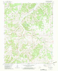
1982 Map of High Prairie
USGS Topo · Published 1983About this map
The Osage Fork Gasconade River and the East Fork Niangua River carve through the dissected plateau of the Ozark Prairie in this early 1980s topographical study. This region of Webster County is defined by a deep network of rural institutions, from the Old Liberty Ch in the southeast to the clusters of family and community burial grounds such as the Shields-Corinth Cem and Robertson-Buck Cem.
Find a feature on this map
29 named features on this map. Tap any name to fly to it.
Don’t see what you’re looking for? This feature index may not catch every label — zoom into the map to look around manually.
Map Details
Editions of this 1982 High Prairie Map
This is the sole edition of this map. No revisions or reprints were ever made.
Other maps of this area

1939 · Fordland
USGS Topo · 1:62,500

1942 · Fordland
USGS Topo · 1:62,500

1946 · Niangua
USGS Topo · 1:62,500

1948 · Niangua
USGS Topo · 1:62,500

1951 · Mansfield NW
USGS Topo · 1:24,000

1954 · Springfield
USGS Topo · 1:250,000

1956 · Duncan
USGS Topo · 1:24,000

1956 · Rader
USGS Topo · 1:24,000

1958 · Springfield
USGS Topo · 1:250,000

1959 · Springfield
USGS Topo · 1:250,000