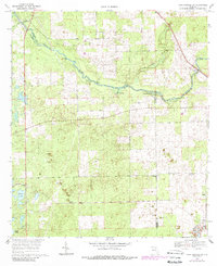
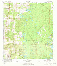
1969 Map of High Springs SW
USGS Topo · Published 1988About this map
The Santa Fe River carves a winding path along the northern boundary of this 1969 Florida survey, defining the intersection of Gilchrist, Alachua, and Columbia counties. This riverine landscape is notable for its concentration of freshwater springs, including Ginnie Spring, Blue Springs, and Poe Spring, which punctuate the banks near Rum Island. The karst topography of the region is evident in the numerous depressions and small water bodies like Bagget Lake and Fish Pond that scatter across the interior.
Find a feature on this map
21 named features on this map. Tap any name to fly to it.
Don’t see what you’re looking for? This feature index may not catch every label — zoom into the map to look around manually.
Map Details
Editions of this 1969 High Springs SW Map
Other maps of this area

1954 · Gainesville
USGS Topo · 1:250,000

1958 · Gainesville
USGS Topo · 1:250,000

1959 · Gainesville
USGS Topo · 1:250,000

1962 · High Springs
USGS Topo · 1:24,000

1962 · Mikesville
USGS Topo · 1:24,000

1968 · Waters Lake
USGS Topo · 1:24,000

1968 · Newberry
USGS Topo · 1:24,000

1968 · Fourmile Lake
USGS Topo · 1:24,000
1968 · Hildreth
USGS Topo · 1:24,000
1968 · Bell
USGS Topo · 1:24,000