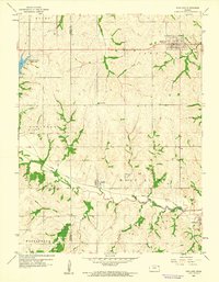
1959 Map of Highland
USGS Topo · Published 1960About this map
The town of Highland anchors the northeastern corner of this 1959 Doniphan County landscape, characterized by the winding tributaries of the Wolf River. This survey captures the agricultural heart of the region at the end of the 1950s, showing the precise layout of the Union Pacific railroad as it cuts through Leona and curves south toward Severance. The terrain is deeply etched by a network of waterways including Mission Creek and Cedar Creek, which dictate the placement of local infrastructure like the Bellevue School and the Highland Cemetery.
Find a feature on this map
23 named features on this map. Tap any name to fly to it.
Don’t see what you’re looking for? This feature index may not catch every label — zoom into the map to look around manually.
Map Details
Editions of this 1959 Highland Map
This is the sole edition of this map. No revisions or reprints were ever made.
Other maps of this area

1885 · Atchison
USGS Topo · 1:125,000

1888 · Atchison
USGS Topo · 1:125,000

1893 · Atchison
USGS Topo · 1:125,000

1926 · Atchison
USGS Topo · 1:62,500

1926 · Oregon
USGS Topo · 1:62,500

1950 · Kansas City
USGS Topo · 1:250,000

1954 · Kansas City
USGS Topo · 1:250,000

1956 · Kansas City
USGS Topo · 1:250,000
1959 · Oregon
USGS Topo · 1:24,000
1959 · White Cloud
USGS Topo · 1:24,000