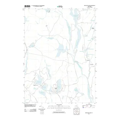
2010 Map of Highland Lake
USGS Topo · Published 2010About this map
Mohican Lake and the village of Highland Lake serve as the primary hubs of this landscape, where residential clusters meet a dense network of water bodies. The geography is defined by a series of significant reservoirs and ponds, including the large Swinging Bridge Reservoir and the Toronto Reservoir in the north, while the Mongaup River and Black Brook feed into the expansive Rio Reservoir and Mongaup Falls Reservoir to the south. This pattern of drainage suggests a history of water management and hydropower, evidenced by features such as the Wickman Millpond. Smaller settlements like Forestburg, Fowlerville, and Squirrels Corners are connected by a web of local roads such as Sackett Lake Rd and Plank Road Section B, reflecting a community oriented around these scattered glacial lakes and timbered uplands like Chapin Hill.
Find a feature on this map
72 named features on this map. Tap any name to fly to it.
Don’t see what you’re looking for? This feature index may not catch every label — zoom into the map to look around manually.
Map Details
Editions of this 2010 Highland Lake Map
This is the sole edition of this map. No revisions or reprints were ever made.
Other maps of this area

1906 · Port Jervis
USGS Topo · 1:62,500

1908 · Port Jervis
USGS Topo · 1:62,500

1909 · Monticello
USGS Topo · 1:62,500

1911 · Monticello
USGS Topo · 1:62,500

1913 · Milford
USGS Topo · 1:62,500

1915 · Milford
USGS Topo · 1:62,500

1922 · White Lake
USGS Topo · 1:62,500

1942 · White Lake
USGS Topo · 1:62,500

1942 · Port Jervis North
USGS Topo · 1:24,000
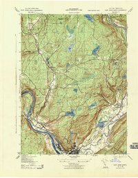
1943 · Port Jervis North
USGS Topo · 1:31,680