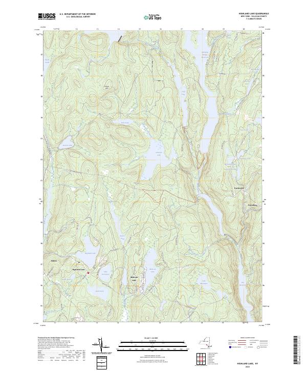
2023 Map of Highland Lake
USGS Topo · Published 2023About this map
Mohican Lake and the surrounding resort communities of Highland Lake and Eldred define this corner of Sullivan County. The landscape is dominated by a complex network of glacial water bodies and significant modern impoundments, including portions of the Swinging Bridge Reservoir and Rio Reservoir. Transportation history is visible through the corridor of the Old Lumberland Tpke, which once served as a primary route through these highlands. To the east, the Mongaup River drainage supports several smaller named ponds and historical markers like the Wickman Millpond. The map details the transition from high points like Chapin Hill down to the river valleys, showing the dense clustering of camps and summer homes that have characterized the local economy and social fabric for generations near settlements like Fowlerville and Forestburg.
Find a feature on this map
87 named features on this map. Tap any name to fly to it.
Don’t see what you’re looking for? This feature index may not catch every label — zoom into the map to look around manually.
Map Details
Editions of this 2023 Highland Lake Map
This is the sole edition of this map. No revisions or reprints were ever made.
Other maps of this area

1906 · Port Jervis
USGS Topo · 1:62,500

1908 · Port Jervis
USGS Topo · 1:62,500

1909 · Monticello
USGS Topo · 1:62,500

1911 · Monticello
USGS Topo · 1:62,500

1913 · Milford
USGS Topo · 1:62,500

1915 · Milford
USGS Topo · 1:62,500

1922 · White Lake
USGS Topo · 1:62,500

1942 · White Lake
USGS Topo · 1:62,500

1942 · Port Jervis North
USGS Topo · 1:24,000
1943 · Port Jervis North
USGS Topo · 1:31,680