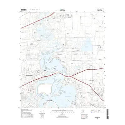
2016 Map of Highlands
USGS Topo · Published 2016About this map
The San Jacinto River and Buffalo Bayou converge in this industrial and coastal landscape, where the Houston Ship Channel dominates the southern reaches. This area is a complex network of waterways, featuring the Lynchburg Reservoir and the expansive Burnet Bay. Historically significant sites like Lynchburg and the DeZavalla Cem sit near the water's edge, marking the long-standing human presence at these critical junctions. To the north, the communities of Highlands and Barrett show established residential grids, while the eastern edge is defined by the Highlands Reservoir. The map illustrates a high-density intersection of industry and nature, with the Mantu and Channelview settlements positioned between the river and the sloughs, reflecting the region's reliance on maritime transport and the energy sector.
Find a feature on this map
154 named features on this map. Tap any name to fly to it.
Don’t see what you’re looking for? This feature index may not catch every label — zoom into the map to look around manually.
Map Details
Editions of this 2016 Highlands Map
This is the sole edition of this map. No revisions or reprints were ever made.
Other maps of this area

1915 · Deepwater
USGS Topo · 1:24,000

1916 · Burnett Bay
USGS Topo · 1:24,000

1916 · Crosby
USGS Topo · 1:24,000

1916 · Morgan Point
USGS Topo · 1:24,000

1916 · Fauna
USGS Topo · 1:24,000

1916 · Harmaston
USGS Topo · 1:24,000

1916 · Cedar Bayou
USGS Topo · 1:24,000

1916 · La Porte
USGS Topo · 1:24,000

1919 · Morgan Point
USGS Topo · 1:31,680

1919 · Deepwater
USGS Topo · 1:31,680