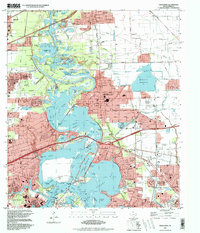
1995 Map of Highlands
USGS Topo · Published 1998About this map
The San Jacinto River and Buffalo Bayou converge in this detailed late-century survey, a landscape defined by the intersection of Texas history and industrial expansion. The historic San Jacinto Monument stands prominently within San Jacinto State Park, marking the site of the 1836 battle near the shores of Burnet Bay. This area, encompassing the communities of Highlands, Channelview, and parts of Baytown, reveals a complex network of infrastructure including the Southern Pacific railroad and extensive chemical plants and refineries that drove the regional economy.
Find a feature on this map
82 named features on this map. Tap any name to fly to it.
Don’t see what you’re looking for? This feature index may not catch every label — zoom into the map to look around manually.
Map Details
Editions of this 1995 Highlands Map
This is the sole edition of this map. No revisions or reprints were ever made.
Other maps of this area

1915 · Deepwater
USGS Topo · 1:24,000

1916 · Burnett Bay
USGS Topo · 1:24,000

1916 · Crosby
USGS Topo · 1:24,000

1916 · Morgan Point
USGS Topo · 1:24,000

1916 · Fauna
USGS Topo · 1:24,000

1916 · Harmaston
USGS Topo · 1:24,000

1916 · Cedar Bayou
USGS Topo · 1:24,000

1916 · La Porte
USGS Topo · 1:24,000

1919 · Morgan Point
USGS Topo · 1:31,680

1919 · Deepwater
USGS Topo · 1:31,680