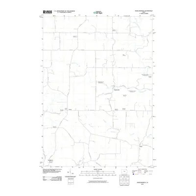
2010 Map of Highlandville
USGS Topo · Published 2010About this map
Highlandville and Locust serve as the primary focal points of this northeastern Iowa landscape, where the intricate network of creek valleys dictates the pattern of settlement. The terrain is defined by the winding paths of North Bear Creek, South Bear Creek, and Paint Creek, which carve through the countryside and support several recreational access areas. This 2010 survey highlights a significant concentration of family and community burial grounds, such as the Fawcett Farm Cemetery and Stoen Farm Cemetery, which provide invaluable spatial data for genealogical research in Winneshiek County. Historical institutional sites like the Locust School and Saint John Cemetery are preserved alongside small clusters at Sattre and Springwater, reflecting the enduring rural character of the region. The map reveals how local transit remains tied to the geography, with routes like Sattre Ridge Rd and Highlandville Rd following the high ground between the various creek systems.
Find a feature on this map
45 named features on this map. Tap any name to fly to it.
Don’t see what you’re looking for? This feature index may not catch every label — zoom into the map to look around manually.
Map Details
Editions of this 2010 Highlandville Map
This is the sole edition of this map. No revisions or reprints were ever made.
Other maps of this area

1906 · Decorah
USGS Topo · 1:125,000

1958 · La Crosse
USGS Topo · 1:250,000

1961 · La Crosse
USGS Topo · 1:250,000

1965 · La Crosse
USGS Topo · 1:250,000

1965 · Wilmington
USGS Topo · 1:24,000

1965 · Mabel
USGS Topo · 1:24,000

1965 · Spring Grove
USGS Topo · 1:24,000
1971 · Dorchester
USGS Topo · 1:24,000
1971 · Hanover
USGS Topo · 1:24,000

1975 · Decorah 1 NW
USGS Topo · 1:24,000