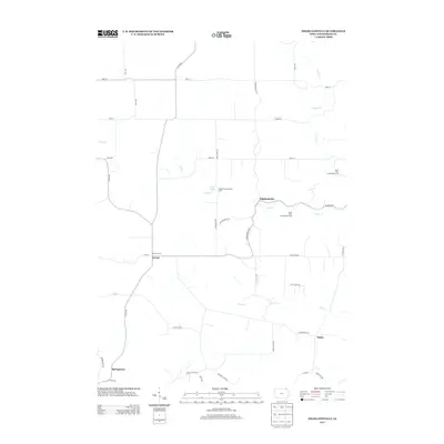
2013 Map of Highlandville
USGS Topo · Published 2013About this map
Highlandville and Locust are the primary small-town anchors in this Winneshiek County landscape, where the road network follows a transition between upland plateaus and deep-cut creek valleys. The settlement of Locust features the Locust School, a local landmark at the intersection of Locust Rd and 337th St. Public access to the outdoors is well-represented through specialized conservation zones, including the North Bear Creek Access Area, South Bear Creek Access Area, and Mestad Spring Access Area.
Find a feature on this map
42 named features on this map. Tap any name to fly to it.
Don’t see what you’re looking for? This feature index may not catch every label — zoom into the map to look around manually.
Map Details
Editions of this 2013 Highlandville Map
This is the sole edition of this map. No revisions or reprints were ever made.
Other maps of this area

1906 · Decorah
USGS Topo · 1:125,000

1958 · La Crosse
USGS Topo · 1:250,000

1961 · La Crosse
USGS Topo · 1:250,000

1965 · La Crosse
USGS Topo · 1:250,000

1965 · Wilmington
USGS Topo · 1:24,000

1965 · Mabel
USGS Topo · 1:24,000

1965 · Spring Grove
USGS Topo · 1:24,000
1971 · Dorchester
USGS Topo · 1:24,000
1971 · Hanover
USGS Topo · 1:24,000

1975 · Decorah 1 NW
USGS Topo · 1:24,000