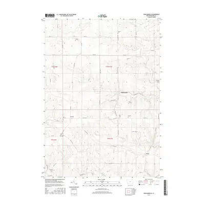
2015 Map of Highlandville
USGS Topo · Published 2015About this map
Highlandville and the surrounding townships of Winneshiek County are defined by a complex network of ridges and river valleys, including the drainages of S Bear Cr and Paint Cr. The landscape is dotted with several small, historically significant settlements such as Locust and Sattre, which serve as anchor points for the rural road system. This survey is particularly notable for its dense concentration of burial grounds, many of which are associated with early pioneer families and local congregations. Researchers will find numerous sites of genealogical interest, from the Methodist Cem and Big Canoe Cem to smaller family plots like the Stoen Farm Cem and Fawcett Farm Cem. The topography is shaped by the winding paths of Sattre Ridge Rd and Big Canoe Rd, following the natural contours of the Driftless Area terrain and connecting the scattered farmsteads and springs like Mestall Spring.
Find a feature on this map
57 named features on this map. Tap any name to fly to it.
Don’t see what you’re looking for? This feature index may not catch every label — zoom into the map to look around manually.
Map Details
Editions of this 2015 Highlandville Map
This is the sole edition of this map. No revisions or reprints were ever made.
Other maps of this area

1906 · Decorah
USGS Topo · 1:125,000

1958 · La Crosse
USGS Topo · 1:250,000

1961 · La Crosse
USGS Topo · 1:250,000

1965 · La Crosse
USGS Topo · 1:250,000

1965 · Wilmington
USGS Topo · 1:24,000

1965 · Mabel
USGS Topo · 1:24,000

1965 · Spring Grove
USGS Topo · 1:24,000
1971 · Dorchester
USGS Topo · 1:24,000
1971 · Hanover
USGS Topo · 1:24,000

1975 · Decorah 1 NW
USGS Topo · 1:24,000