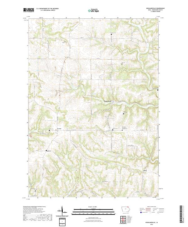
2022 Map of Highlandville
USGS Topo · Published 2022About this map
The unincorporated community of Highlandville sits at the intersection of Quandahl Rd and Highlandville Rd, serving as a central point in this Winneshiek County landscape. The area is defined by a dense network of family-named landmarks and rural burial grounds, including the Big Canoe Norwegian Methodist Cem and several small plots such as Fawcett Farm Cem and Stoen Farm Cem. These features, along with the settlement at Locust, reflect the deep-rooted agricultural and ethnic heritage of this corner of northeast Iowa.
Find a feature on this map
51 named features on this map. Tap any name to fly to it.
Don’t see what you’re looking for? This feature index may not catch every label — zoom into the map to look around manually.
Map Details
Editions of this 2022 Highlandville Map
This is the sole edition of this map. No revisions or reprints were ever made.
Other maps of this area

1906 · Decorah
USGS Topo · 1:125,000

1958 · La Crosse
USGS Topo · 1:250,000

1961 · La Crosse
USGS Topo · 1:250,000

1965 · La Crosse
USGS Topo · 1:250,000

1965 · Wilmington
USGS Topo · 1:24,000

1965 · Mabel
USGS Topo · 1:24,000

1965 · Spring Grove
USGS Topo · 1:24,000
1971 · Dorchester
USGS Topo · 1:24,000
1971 · Hanover
USGS Topo · 1:24,000

1975 · Decorah 1 NW
USGS Topo · 1:24,000