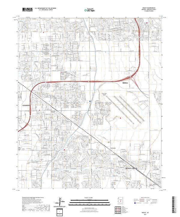
2021 Map of Higley
USGS Topo · Published 2021About this map
Phoenix-Mesa Gateway Airport occupies a central role in this East Valley landscape, reflecting the modern transition of the area from agricultural roots to a significant aviation and educational hub. The map captures the suburban expansion where Mesa and Gilbert meet, centered around the historic settlement of Higley. This area, once defined by the vital waters of the Roosevelt WCD Canal and Queen Cr Canal, has evolved into a dense residential and academic corridor. Higher education institutions, including the Arizona State University Polytechnic Campus and the Chandler - Gilbert Community College Williams Campus, are shown established on the former airfield grounds. Further south, the community of Germann and the growing town of Queen Creek demonstrate the southward reach of the Phoenix metropolitan area into what was once open desert and ranch land.
Find a feature on this map
26 named features on this map. Tap any name to fly to it.
Don’t see what you’re looking for? This feature index may not catch every label — zoom into the map to look around manually.
Map Details
Editions of this 2021 Higley Map
This is the sole edition of this map. No revisions or reprints were ever made.
Other maps of this area

1904 · Desert Well
USGS Topo · 1:62,500

1906 · Desert Well
USGS Topo · 1:62,500

1907 · Sacaton
USGS Topo · 1:62,500

1913 · Mesa
USGS Topo · 1:62,500

1914 · Gila Butte
USGS Topo · 1:62,500

1915 · Mesa
USGS Topo · 1:62,500

1917 · Gila Butte
USGS Topo · 1:62,500

1952 · Chandler
USGS Topo · 1:24,000
1952 · Mesa
USGS Topo · 1:24,000

1952 · Gila Butte
USGS Topo · 1:24,000