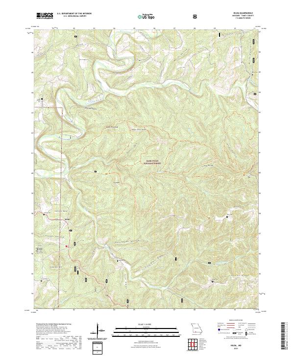
2021 Map of Hilda
USGS Topo · Published 2021About this map
The settlement of Hilda and the expansive drainage of Beaver Creek define this landscape in Taney County. The terrain is deeply carved by a network of hollows and ridges, including North Hollow, Pees Hollow, and Slough Hollow, punctuated by high points like Lower Pilot Knob, Upper Pilot Knob, and Coy Bald. Much of the central and eastern portions of the quadrangle are encompassed by the Mark Twain National Forest, indicating a landscape largely preserved in its natural state. Genealogists will find a significant number of small burial sites scattered across the ridges and valley floors, including Lone Pilgrim Cem, Johnson Cem, Blair Cem, and Edley Cem. These sites, often located near historical roads such as Blair Ridge Rd and State Hwy FF, offer clues to the early families who settled this part of the Ozarks.
Find a feature on this map
52 named features on this map. Tap any name to fly to it.
Don’t see what you’re looking for? This feature index may not catch every label — zoom into the map to look around manually.
Map Details
Editions of this 2021 Hilda Map
This is the sole edition of this map. No revisions or reprints were ever made.
Other maps of this area

1907 · Forsyth
USGS Topo · 1:125,000

1937 · Bradleyville
USGS Topo · 1:48,000

1943 · Protem
USGS Topo · 1:62,500

1943 · Bradleyville
USGS Topo · 1:62,500

1945 · Harrison
USGS Topo · 1:250,000

1945 · Bradleyville
USGS Topo · 1:62,500

1949 · Harrison
USGS Topo · 1:250,000

1954 · Harrison
USGS Topo · 1:250,000

1955 · Garrison
USGS Topo · 1:24,000
1956 · Mincy
USGS Topo · 1:24,000