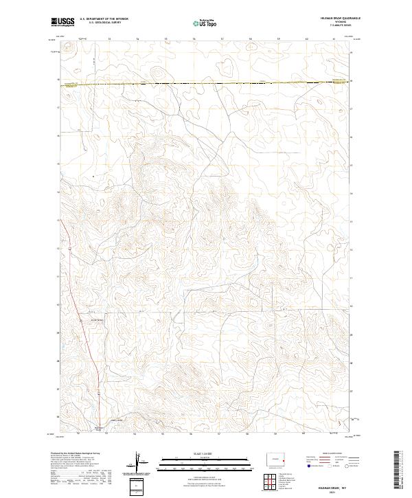
2021 Map of Hileman Draw
USGS Topo · Published 2021About this map
Little Tetons rises as a distinct topographical marker in this high-plains landscape where the border between Niobrara County and Goshen County is surveyed across the northern section. The terrain is defined by dry drainage systems, most notably Hileman Draw and Lowry Draw, which converge in the southwestern portion of the map. These natural watercourses dictated the early settlement patterns and cattle-driving routes of the region.
Find a feature on this map
17 named features on this map. Tap any name to fly to it.
Don’t see what you’re looking for? This feature index may not catch every label — zoom into the map to look around manually.
Map Details
Editions of this 2021 Hileman Draw Map
This is the sole edition of this map. No revisions or reprints were ever made.
Other maps of this area

1896 · Patrick
USGS Topo · 1:125,000

1954 · Torrington
USGS Topo · 1:250,000

1958 · Torrington
USGS Topo · 1:250,000

1974 · Mc Master Reservoir
USGS Topo · 1:24,000
1974 · Jay Em NW
USGS Topo · 1:24,000

1974 · Jay Em
USGS Topo · 1:24,000

1974 · Rawhide Buttes East
USGS Topo · 1:24,000
1974 · Reynolds Spring
USGS Topo · 1:24,000

1977 · Hileman Draw
USGS Topo · 1:24,000

1977 · Prairie Center
USGS Topo · 1:24,000