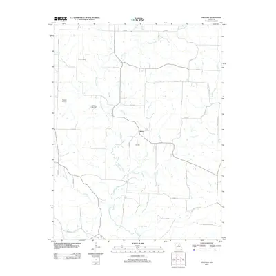
2012 Map of Hilldale
USGS Topo · Published 2012About this map
Moniteau Creek and its many tributaries, including Hunters Creek and Caney Branch, define the rural geography of this Howard County landscape. At the center of this drainage network lies the small settlement of Hilldale, surrounded by a grid of county roads that navigate the local topography. This 2012 survey illustrates the persistent agricultural and cemetery sites that anchor the local community, such as Ricketts Cemetery in the north and Hourigan Cemetery near the town center. The presence of Big Spring and U.S. Salt Springs indicates a landscape shaped by natural water sources, while Petersen Lake Dam and Wies Lake Dam show more modern modifications to the local hydrology. The area is characterized by these small-scale landmarks and a dense network of local routes like Tipton Rd and Route J Rocheport.
Find a feature on this map
49 named features on this map. Tap any name to fly to it.
Don’t see what you’re looking for? This feature index may not catch every label — zoom into the map to look around manually.
Map Details
Editions of this 2012 Hilldale Map
This is the sole edition of this map. No revisions or reprints were ever made.
Other maps of this area

1886 · Jefferson City
USGS Topo · 1:125,000

1888 · Boonville
USGS Topo · 1:125,000

1890 · Moberly
USGS Topo · 1:125,000

1890 · Glasgow
USGS Topo · 1:125,000

1894 · Jefferson City
USGS Topo · 1:125,000

1917 · Sturgeon
USGS Topo · 1:62,500

1947 · Jefferson City
USGS Topo · 1:250,000

1948 · Columbia
USGS Topo · 1:62,500

1950 · Columbia
USGS Topo · 1:62,500

1952 · Rocheport
USGS Topo · 1:24,000