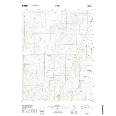
2017 Map of Hilldale
USGS Topo · Published 2017About this map
Moniteau Creek and its many tributaries, including Cane Br and Pipes Br, carve a dense network of drainages through this portion of central Missouri. The small settlement of Hilldale serves as a central point in a landscape defined by its hydrography and agricultural grid. Of particular interest to local historians are the mineral features near the county line, such as Big Spring and the U S Salt Springs, which hint at the natural resources that once drew early interest to this region. The map also documents the locations of several family and community burial grounds, including Ricketts Cem, Hourigan Cem, and Walnut Grove Cem, providing valuable data for genealogical research. The transition between Howard and Boone counties is clearly delineated, showing how contemporary state routes like State Hwy A and State Rte EE navigate the winding stream valleys.
Find a feature on this map
61 named features on this map. Tap any name to fly to it.
Don’t see what you’re looking for? This feature index may not catch every label — zoom into the map to look around manually.
Map Details
Editions of this 2017 Hilldale Map
This is the sole edition of this map. No revisions or reprints were ever made.
Other maps of this area

1886 · Jefferson City
USGS Topo · 1:125,000

1888 · Boonville
USGS Topo · 1:125,000

1890 · Moberly
USGS Topo · 1:125,000

1890 · Glasgow
USGS Topo · 1:125,000

1894 · Jefferson City
USGS Topo · 1:125,000

1917 · Sturgeon
USGS Topo · 1:62,500

1947 · Jefferson City
USGS Topo · 1:250,000

1948 · Columbia
USGS Topo · 1:62,500

1950 · Columbia
USGS Topo · 1:62,500

1952 · Rocheport
USGS Topo · 1:24,000