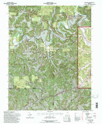
1993 Map of Hillham
USGS Topo · Published 1996About this map
Lost River snakes through the heavily wooded terrain of the Hoosier National Forest in this detailed survey of southern Indiana. The landscape is defined by its subterranean geography and limestone karst features, including Outlaw Cave and the dry reaches of Dry Hollow. The settlement pattern follows the high ground along Emmons Ridge and the Powell Valley Road, where small communities like Hillham and Natchez are anchored by long-standing landmarks such as the Natchez Sch and Natchez Cem. In the east, the map captures the outskirts of the famous resort towns West Baden Springs and French Lick, showing the French Lick Municipal Airport and a local Golf Course. Industrial and transit history is evident at the Red Quarry and the Burton Tunnel railroad passage, providing a clear picture of the region's 20th-century rural economy.
Find a feature on this map
50 named features on this map. Tap any name to fly to it.
Don’t see what you’re looking for? This feature index may not catch every label — zoom into the map to look around manually.
Map Details
Editions of this 1993 Hillham Map
This is the sole edition of this map. No revisions or reprints were ever made.
Other maps of this area

1948 · Huron
USGS Topo · 1:24,000

1949 · Georgia
USGS Topo · 1:24,000

1950 · Huron
USGS Topo · 1:24,000

1950 · Shoals
USGS Topo · 1:24,000

1951 · Hillham
USGS Topo · 1:24,000

1951 · French Lick
USGS Topo · 1:24,000

1951 · Georgia
USGS Topo · 1:24,000

1954 · Dubois
USGS Topo · 1:24,000

1956 · Greenbrier
USGS Topo · 1:24,000

1956 · Rusk
USGS Topo · 1:24,000